Climate of Burkina Faso
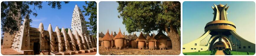
Where is the country of Burkina Faso located? Burkina Faso is a country in western Africa. Until 1984, the country was known as Upper Volta. Burkina Faso is a positive exception to many neighboring countries when it comes to outbreaks of violence, where power changes were sometimes accompanied by extreme violence. Burkina Faso consists largely of peneplains and lies at an average altitude of four hundred meters above sea level. The highest point of the fairly flat country is Ténakourou, with an elevation of 749 meters above sea level. Burkina Faso falls in the transition zone of the tropical savanna climate and the drier warm steppe climate. In the northern part, which is in the Sahel, there is a small zone that can be categorized under the warm desert climate.
Rainy season
Burkina Faso has a dry season that coincides with the climatic winter in the Northern Hemisphere. From November to the second half of April it is dry in almost the entire country. Rain showers are relatively rare and if it does rain once, the amounts are relatively few. By May there will be a weather change to a wetter weather type. The wet season starts in May and lasts until mid-October. Without exception, on average the most precipitation falls in the month of August. In the wettest areas, the precipitation sum in August is around three hundred millimeters (long-term average). During wet years this can easily increase to more than four hundred millimeters.
Heat
Burkina Faso is one of the warmest countries in the region, because the tempering effect of the sea is not present and the sun has plenty of opportunity to warm the air. In the period from March to May, the average maximum temperatures are between 36 and 42 degrees. Days on which these values are passed also occur. Especially the north, which is located in the Sahel, sometimes has days when the mercury rises towards fifty degrees. The start of the rainy season not only means an increasing chance of precipitation, it also means that temperatures drop slightly during the day and at night. Temperatures will temporarily rise after the rainy season, but the mercury will not skyrocket as high as at the end of the dry season.
Climate figures
The figures below are based on long-term average climate statistics. The temperatures are displayed in degrees Celsius (°C).
| Maximum temperature | Minimum temperature | Hours of sunshine per day | Days of rainfall per month | |
| January | 33℃ | 17℃ | 9 | 1 |
| February | 36℃ | 20℃ | 9 | 1 |
| March | 38℃ | 24℃ | 8 | 2 |
| April | 40℃ | 27℃ | 8 | 4 |
| May | 39℃ | 27℃ | 8 | 7 |
| June | 35℃ | 25℃ | 8 | 10 |
| July | 32℃ | 24℃ | 7 | 13 |
| August | 32℃ | 23℃ | 7 | 17 |
| September | 33℃ | 23℃ | 7 | 15 |
| October | 36℃ | 23℃ | 9 | 7 |
| November | 36℃ | 20℃ | 9 | 1 |
| December | 33℃ | 17℃ | 9 | 1 |
Best time to visit Burkina Faso
Do you want to know when is the best time to travel to Burkina Faso? You can determine the best time to travel to a destination based on the weather and climate. In addition, there are other factors that are not directly related to the weather and that can influence the best travel periods for a travel destination. Think, for example, of holidays or festive periods, which makes traveling more interesting or not, because daily life comes to a standstill as a result. Burkina Faso is located in western Africa. The northern part of the country lies within the Sahel. This region runs from all the way from the west to the east of Africa and forms the boundary between the Sahara desert and the rainforests further south. Due to climate change, the dry Sahel is increasingly transforming from a savanna area to a desert zone. Burkina Faso has three climatic zones from north to south: the warm desert climate (BWh), the warm steppe climate (BSh) and the tropical savanna climate (Aw).
Best months
The annual precipitation sum increases the further south you go. In the north 300 to 500 millimeters of rainfall per year is normal, in the centrally located capital Ouagadougou 700 to 800 millimeters of precipitation is usual and in the south the annual sum quickly goes to 1000 mm or more. However, there is one clear similarity: the rain in Burkina Faso mainly falls during the summer. The winter months are dry to very dry. The combination of precipitation and temperature make November, December and January the ideal travel months for a visit to Burkina Faso. Februarycan also be counted among the best travel times despite the heat. It is then dry and warm to very hot (32 to 36 degrees Celsius). Due to the low relative humidity, it is then bearable.
Heat
Towards the end of February, temperatures rise sharply in Burkina Faso. In the south it seems to be not too bad with 35-36 degrees, but in the northern half of Burkina Faso temperatures of 37 to 43 degrees are very normal in the period from March to June.
The wetter season
From May/June you can see the precipitation suddenly increase. The wet season is upon us. Most rain falls in the south. In the north and central part of Burkina Faso it is slightly less heavy in terms of rainfall. Most rain falls in the months of July and August. You can see the temperatures drop a bit. Due to the high relative humidity in this period it is very clammy.
Sandstorms
Sandstorms can occur in Burkina Faso. This mainly happens in the dry season and especially in the northern half of the country. Such sandstorms can completely obscure your view. So much sand can be carried into the air that it becomes completely dark the moment you get into a sandstorm. Large sandstorms can be clearly visible in satellite photos due to the enormous proportions.