Climate of Nicaragua
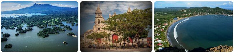
Where is the country of Nicaragua located? Nicaragua is a country located centrally in Central America, bordering Honduras to the north and Costa Rica to the south. Nicaragua has a total of more than nine hundred kilometers of coastline, about two-thirds of which is along the Caribbean Sea and one-third along the Pacific Ocean. The climate of Nicaragua consists of a variation of the three tropical climates. The northwest and east have tropical rainforest climates, the central part and southwest have tropical monsoon climates and tropical savanna climates.
Mountain areas
The mountainous area in Central Nicaragua can be divided into three zones. The ‘lowland’, which is located up to an altitude of 750 meters, is one of the warmest areas of Nicaragua. Where in the coastal areas of Nicaragua the daytime temperatures in the hottest months rise to slightly above thirty degrees, it can easily become a few degrees warmer in the lower areas inland. Particularly in the hottest months (March and April), the mercury can easily rise to as much as 35 or 36 degrees Celsius. In the central highlands, which have altitudes between 750 and 1600 meters, maximum temperatures are comparable to the coastal areas. The highest places in Nicaragua, called the ‘cold land’, have an average maximum temperature of 22 to 24 degrees, while the mercury can drop to an average of ten to fifteen degrees at night. It never gets so cold that snow falls these days, but there are reports of snowfall on the mountain tops in the distant past. Climate changes have ensured that it is no longer cold enough to make it snow in Nicaragua. Those who want to go on winter sports will therefore have to forget about Nicaragua as a ski destination.
Rainfall
Nicaragua is one of the wettest countries in Central America. Annual rainfall varies from just under a thousand millimeters (in the driest places on the leeward side of the mountains) to over six thousand millimeters (on the windward side of the mountains). The central part of Nicaragua has a real rainy season, in which the most precipitation falls by far in the summer and the period from November to April is considerably drier. In the northwest and east, the differences are much smaller within a year and there is generally no longer a real rainy season or a clearly demonstrable dry period.
Hurricanes
Nicaragua is located in an area prone to hurricanes. The eastern half of the country is within reach of tropical storms, tropical depressions, and hurricanes. During the hurricane season – which lasts from June to December – there is a chance of heavy rain, storms and tidal waves due to hurricane activity. While the chances of a depression that turned into a hurricane heading full course for Nicaragua is not that great, there is a significant chance of heavy rainfall, with the large amounts falling within 24 hours leading to flooding, mudslides and landslides. Especially in places where the tropical rainforest has had to make way for cattle breeding or because the wood has been cut for export, the soil is more sensitive to problems due to flooding.
Climate figures
The figures below are based on long-term average climate statistics. The temperatures are displayed in degrees Celsius (°C).
| Maximum temperature | Minimum temperature | Hours of sunshine per day | Days of rainfall per month | |
| January | 32℃ | 21℃ | 8 | 3 |
| February | 32℃ | 21℃ | 9 | 2 |
| March | 34℃ | 22℃ | 9 | 2 |
| April | 35℃ | 23℃ | 9 | 3 |
| May | 33℃ | 24℃ | 8 | 12 |
| June | 31℃ | 23℃ | 6 | 18 |
| July | 30℃ | 23℃ | 7 | 22 |
| August | 31℃ | 23℃ | 7 | 23 |
| September | 30℃ | 22℃ | 7 | 16 |
| October | 30℃ | 22℃ | 6 | 18 |
| November | 31℃ | 21℃ | 7 | 19 |
| December | 30℃ | 22℃ | 7 | 13 |
Best time to visit Nicaragua
Do you want to know when is the best time to travel to Nicaragua? You can determine the best time to travel to a destination based on the weather and climate. In addition, there are other factors that are not directly related to the weather and that can influence the best travel periods for a travel destination. Think, for example, of holidays or festive periods, which makes traveling more interesting or not, because daily life comes to a standstill as a result. The Republic of Nicaragua is a country located in Central America, bordering both the Pacific Ocean and the Caribbean Sea. The landscape consists of lowlands on the Caribbean coast, a mountainous central part and a mix of lowlands and volcanoes on the Pacific coast. Almost all of Nicaragua has a tropical climate. Which of the three tropical climates applies depends on the amounts of precipitation per month. The mountain peaks have a temperate climate type. Eastern Nicaragua is the wettest part of the country. The tropical rainforest climate dominates here and there is quite a lot of rain throughout the year. The annual precipitation in the Caribbean lowlands varies from 2,500 to over 6,000 millimeters per year. This makes this part of Nicaragua one of the wettest areas in Central America. The mountains that lie centrally in Nicaragua mean that the trade winds have little chance of sending depressions from the east towards the western side of Nicaragua. The western coastal areas are a lot drier: count on about 1000 to 1800 millimeters of rain per year. On that side of Nicaragua it is really a dry season. On the east coast you can speak of a drier season and a clear rainy season. The rainy season starts in Nicaragua in May. The amounts of precipitation then skyrocket. On the east coast, July and August are soaking wet with sometimes more than 500 to 600 millimeters of rain per month. On the Caribbean coast, the rainy season lasts until February. March and April are the only really drier months there. The second half of February is generally better in terms of rain. In the west, the rainy season ends in November, sometimes early December. Temperatures are tropical all year round. In the mountains you see that the temperatures are a bit lower as you get to higher altitudes. In the west it can get hot during the dry season. In the capital Managua, maximum temperatures in March to May rise to an average of 33 to 36 degrees Celsius. Once the rainy season starts, temperatures drop a bit. It doesn’t seem to get any cooler because of the humidity.
Best months
The best time to travel to Nicaragua is from February to April. This is the general travel advice for all of Nicaragua, for example if you are going to make a round trip where you come to both the west and the east. If you don’t take the eastern side (there are quite a few people who do), December and January are also great travel months to travel around.
Beach holiday
If you want to travel to Nicaragua for a beach holiday, the period from December to April is great for the west coast. The sea water is then about 27-28 degrees and the sun shows itself sufficiently. The Caribbean coast is less sunny anyway. Because there is still quite a lot of rain in December and January, the period from mid-February to the end of April is the best travel time for a holiday in the sun.