Climate of Honduras
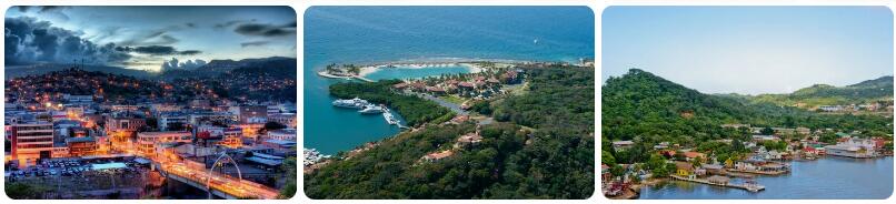
Where is the country of Honduras located? Honduras is a country in Central America bordering Guatemala, El Salvador and Nicaragua. The northern side of Honduras borders the Caribbean Sea, in the south you will find a piece of coastal area along the Fonseca Bay. This bay is located on the Pacific Ocean. A fairly large part of Honduras consists of highlands, in total about eighty percent. The western mountain areas are the highest, with the Pico Congolón (2500 meters) and Cerra Las Minas (2850 meters) as the highest mountains. The highlands ensure that depressions moving from the Caribbean Sea across Honduras follow a path that is partly determined by the landscape. The depressions pull straight through the mountain range, starting from San Pedro Sula, after which the depression ends up in a kind of invisible funnel and straight through the mountain area towards the Fonseca Bay.
Climate zones
According to the Köppen climate classification, Honduras can be divided into four climate zones. The Caribbean lowland, on the north side of the country, has a tropical rainforest climate (type Af), with high temperatures throughout the year and a fairly evenly distributed amount of precipitation over the year. The northwest of Honduras and the lowlands in the south have a tropical monsoon climate. Temperatures are high all year round, but there is a distinct wet season and a dry season. The rainy season, in which there are mainly heavy showers, starts in May and lasts until October. From November to April it is considerably drier in these regions.
The centrally located highlands have to do with a variety of climates. The altitude in particular influences the type of climate here, because the higher you go, the cooler it gets. In this region one speaks of a hot zone up to 1000 meters altitude, a temperate zone between 1000 and 2000 meters above sea level and a cool zone above 2000 meters. That cool is relative, because with temperatures in the summer of up to thirty degrees and in the winter of still between fifteen and twenty degrees, it is not cold in the highest places in Honduras. However, there can be light night frosts on the tops of the mountains in the coolest months. The warmer places in the highlands have a tropical climate (savanna climate or monsoon climate), the cooler places have a warm china climate (type Cwa),
The hurricane
Honduras is located in an area where there is hurricane activity from June to December. Tropical depressions over the Atlantic Ocean between Africa and the Americas almost always move west towards the Caribbean and North America. Honduras is in a location that hurricanes can pass over. Hurricanes that pass hundreds of kilometers away can also cause a lot of nuisance. Not infrequently, the proximity of a hurricane causes a lot of rainfall in the surrounding countries, often resulting in flooding.
Climate figures
The figures below are based on long-term average climate statistics. The temperatures are displayed in degrees Celsius (°C).
| Maximum temperature | Minimum temperature | Hours of sunshine per day | Days of rainfall per month | |
| January | 26℃ | 14℃ | 6 | 3 |
| February | 27℃ | 15℃ | 7 | 3 |
| March | 30℃ | 16℃ | 8 | 5 |
| April | 30℃ | 17℃ | 7 | 7 |
| May | 30℃ | 18℃ | 7 | 15 |
| June | 29℃ | 18℃ | 6 | 22 |
| July | 28℃ | 18℃ | 6 | 21 |
| August | 29℃ | 18℃ | 7 | 20 |
| September | 29℃ | 18℃ | 6 | 22 |
| October | 27℃ | 18℃ | 6 | 21 |
| November | 26℃ | 16℃ | 6 | 14 |
| December | 25℃ | 15℃ | 6 | 8 |
Best time to visit Honduras
Do you want to know when is the best time to travel to Honduras? You can determine the best time to travel to a destination based on the weather and climate. In addition, there are other factors that are not directly related to the weather and that can influence the best travel periods for a travel destination. Think, for example, of holidays or festive periods, which makes traveling more interesting or not, because daily life comes to a standstill as a result. The Republic of Honduras is a country located in the central part of Central America. This largely tropical destination is located on the north side of the Caribbean Sea and is connected to the Pacific Ocean on the south via the Gulf of Fonseca. Due to the mountainous landscape in the central part of Honduras, there is a mix of tropical and subtropical climates. The altitude determines whether there is a tropical or subtropical climate. The precipitation amounts ultimately determine the exact climate type.
Best months
There is no single exact period for Honduras to indicate as the best time to travel. The most suitable month for a tour of Honduras visiting both the Pacific and Caribbean coasts would be April. It is then relatively dry in almost all of Honduras with tropical temperatures that are around thirty degrees during the day and in minimum temperatures that are somewhere between 20 and 24 degrees. March is a good alternative, but then the Caribbean coast (including the islands of Guanaja, Roatan and Utila) is still quite wet. The dry season there is from late March to late May, while December to mid-April is the drier season in large parts of Honduras. In the capital Tegucigalpa there is almost no rain in December, January and February.
Hurricanes
Honduras is located in an area where hurricanes can occur. These severe tropical storms, which can have destructive powers, mainly arise in the period from June to December over the Atlantic Ocean. On average, four to ten hurricanes occur per season, a fairly large proportion of which reach the Caribbean. Every now and then a hurricane comes near Honduras, which can cause heavy rainfall, lashing winds and high waves. Very occasionally, a hurricane develops over the Pacific Ocean reaching Honduras on the southwestern side.