Climate of Guatemala
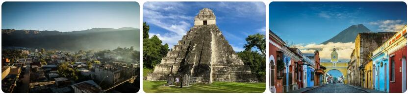
Where is the country of Guatemala located? The country of Guatemala is centrally located in Central America and borders Mexico, Belize, Honduras and El Salvador. Guatemala has four climate types according to the Köppen climate classification. The lowest-lying areas have tropical climates, where the distance from the ocean and the location from the mountains partly determine the exact climate type. The department of Petén, located in the north of the country, is largely due to the tropical rainforest climate (type Af). The Petén Basin receives more precipitation on average than in many other places in Guatemala, and the contrast between the drier and wetter seasons is smaller than in large parts of the country. In Petén you will mainly find large rainforests and a number of important archaeological sites of the Mayan culture. Those who visit this region can visit numerous ruins of Mayan cities such as Tikal, El Mirador and Seibal. The central part of Guatemala, especially in the higher places, has a temperate China climate (type Cwb), with wet summers and dry winters. The coastal areas along the Pacific Ocean (the Pacific Coast) and the areas immediately adjacent to Mexico and the Caribbean Sea have a mixture of a tropical savanna climate and a tropical monsoon climate. Which climate type applies depends on the local precipitation pattern.
Temperatures
Most parts of Guatemala – especially the Mayan cities that are often visited by tourists – have to deal with summer to tropical temperatures almost all year round. In large parts of the country it is between 22 and 25 degrees Celsius during the day in the winter months and the mercury rises to more than 30 degrees in the summer. In the hottest places in Guatemala, the thermometers can reach forty degrees. In the highlands it generally gets a lot less hot and you see that the start of the rainy season brings a moderation of the temperature. For example, you can see that in the capital Guatemala City, the average maximum temperature in June is already going down a bit compared to the month of May. You notice that in this zone, with an altitude of 1000 to 2000 kilometers above sea level, the temperature is quite pleasant. At night it is pleasantly cool without getting really cold and during the hottest days the limit of thirty degrees is not easily broken.
The highest areas, with elevations above 2 kilometers, are not much cooler during the day than the medium-high areas. At night, however, it can get a bit cooler and frost is not a rarity. During the day, the temperature usually rises fairly quickly to pleasant values. Within this zone you will only find one larger city, namely Quetzaltenango. The highest point of Guatemala is the Tajumulco volcano, which with a highest point of 4220 meters above sea level is also the highest mountain in Central America. Winter conditions are not common here, although it can freeze at night in the highest places. However, snowfall is very uncommon, even at this altitude. It was therefore very special that on December 20, 2009 snow fell for the very first time in the highest city of Central America: Ixchiguán.
Precipitation and rainy season
The annual precipitation amounts vary from five hundred millimeters in the southwest to more than three thousand millimeters in some tropical rainforests and on the mountains and volcanoes, such as in Chicholom, where more than 3100 mm of rain falls per year. A clear pattern that applies throughout Guatemala is that November through April is the dry season and May through October is the wet season. For the driest places in Guatemala this means that there is sometimes no significant rainfall for months, the wetter areas have to make do with ‘only’ forty to sixty millimeters per month, which can be compared with the normal precipitation in the Netherlands in the same period. In Guatemala they call the wet season winter and the dry season summer, although it must be officially reversed.
Hurricanes and natural disasters
Guatemala is located in an area where heavy tropical depressions can regularly pass in the period from June to early December. This hurricane season means that hurricanes can also move towards Guatemala, although the chances of landing right in the hurricane’s path are generally less than in some surrounding countries such as Mexico and Belize. However, things can sometimes go wrong in Guatemala, such as in 1998, when Hurricane Mitch came by and Hurricane Stan, which did not pass through Guatemala in October 2005, but did cause considerable damage and casualties in the country. This was caused by the enormous rainfall that Hurricane Stan brought over Central America. Floods, mudslides and landslides have been devastating in some parts of Guatemala. In addition to hurricanes, Guatemala is also at risk of earthquakes and volcanic eruptions. Its location along the boundary between the Caribbean tectonic plate and the North American tectonic plate makes Guatemala vulnerable to earthquakes. The four active volcanoes occasionally cause the necessary panic above the earth’s crust. The volcano Pacaya has regular eruptions, which nowadays also form a tourist attraction.
Climate figures
The figures below are based on long-term average climate statistics. The temperatures are displayed in degrees Celsius (°C).
| Maximum temperature | Minimum temperature | Hours of sunshine per day | Days of rainfall per month | |
| January | 22℃ | 10℃ | 8 | 8 |
| February | 24℃ | 11℃ | 8 | 7 |
| March | 25℃ | 12℃ | 8 | 7 |
| April | 26℃ | 13℃ | 8 | 9 |
| May | 25℃ | 14℃ | 7 | 18 |
| June | 24℃ | 14℃ | 6 | 25 |
| July | 23℃ | 14℃ | 6 | 25 |
| August | 24℃ | 14℃ | 7 | 23 |
| September | 23℃ | 14℃ | 5 | 25 |
| October | 22℃ | 14℃ | 6 | 21 |
| November | 22℃ | 12℃ | 7 | 12 |
| December | 22℃ | 11℃ | 8 | 9 |
Best time to visit Guatemala
Do you want to know when is the best time to travel to Guatemala? You can determine the best time to travel to a destination based on the weather and climate. In addition, there are other factors that are not directly related to the weather and that can influence the best travel periods for a travel destination. Think, for example, of holidays or festive periods, which makes traveling more interesting or not, because daily life comes to a standstill as a result. The country of Guatemala, located in Central America, is fascinating because of its nature and the ancient Maya civilization that has been dominant here for centuries. The combination of archaeological sites, tropical beaches, green rainforests, colonial places and impressive volcanoes make Guatemala a popular destination for a tour. What is special about Guatemala is that it is one of the countries on the American continent that is located on both seas. The western side borders the Pacific Ocean while the eastern regions of Guatemala lie on the Gulf of Honduras. The central part of the country mainly consists of plateaus and mountains. As a result, Guatemala has a fairly diverse climate, with tropical climate types being dominant. The northern half of Guatemala has a savanna climate in the area bordering Mexico. Further south, the climate changes through a monsoon climate into a tropical rainforest climate. In the mountains and on the high plateaus you see that the tropical climates change into subtropical climate types. The higher elevations have a tundra climate. The lowlands in the south of Guatemala have both a monsoon climate and a savanna climate.
Best months
With the exception of the higher parts of Guatemala, it is almost continuously tropical warm throughout the country. The differences are mainly in the precipitation patterns and the annual precipitation sums. These can vary by region. It is therefore slightly more difficult to indicate one specific period as the best time to travel to Guatemala. If we have to choose, then December to April is the best time to go on a holiday in Guatemala. We should mention here that the Pacific coast already has a higher chance of rain in April. For the Caribbean coast, December and January are still quite wet, so the best travel time there is limited to the months of February, March and April.
The hurricane
Tropical storms and hurricanes can occur in Guatemala. They can come from both the Caribbean Sea and the Pacific Ocean, although the chance is somewhat smaller. The hurricane season begins in late June and lasts through November. It is mainly the eastern coast that has the chance to experience the occasional hurricane. As soon as such a tropical depression comes over land, it decreases in strength quite quickly.